We have to think both new and traditional when we test our idea of a pirate-free world. In order for us to be able to alert the authorities and ships about possible pirates at an early stage, we have to use tools that are already in place in addition to some new ones.
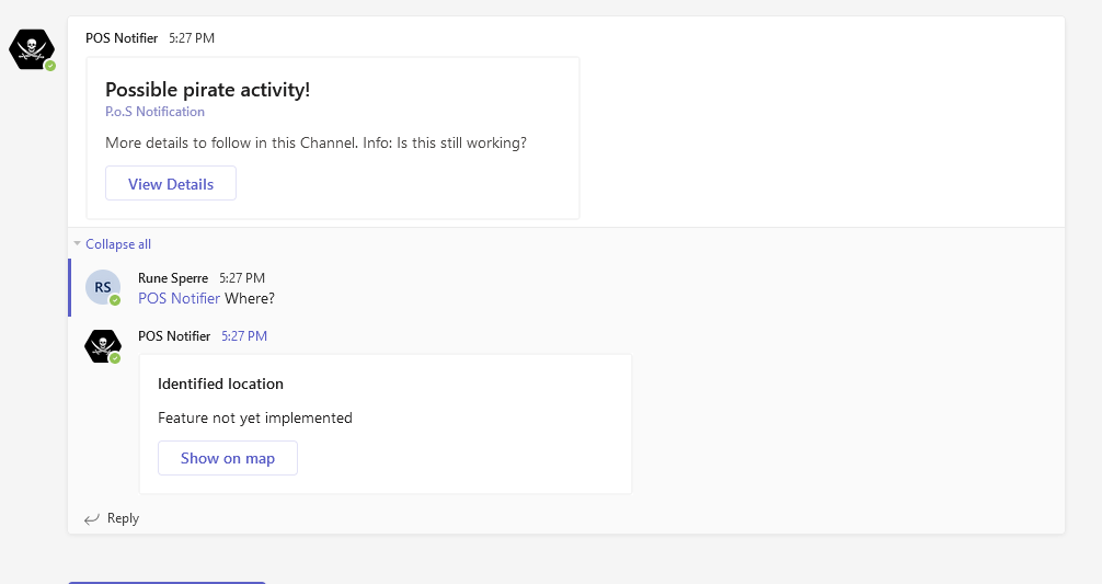
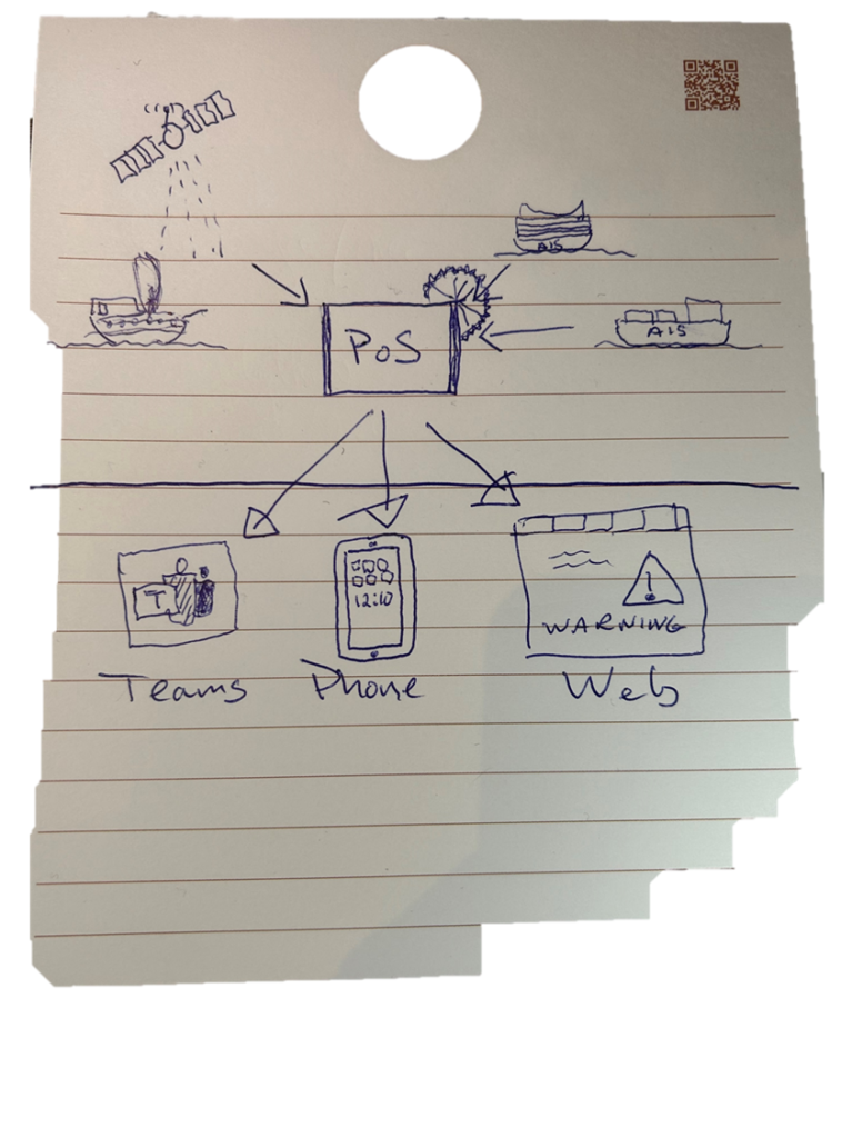
We think that Teams is a perfect channel to get notifications about newly discovered pirate ships, since it’s something we already have. We have created a Teams app that gives us notifications in a Teams channel. Here we have the opportunity to send detailed alerts on situations that arise and at the same time link to our PoS surface for a total overview.
The PoS surface is made in React.js, and the app is built with Vite instead of create-react-app as this is a much faster way to build. New and hip 😉
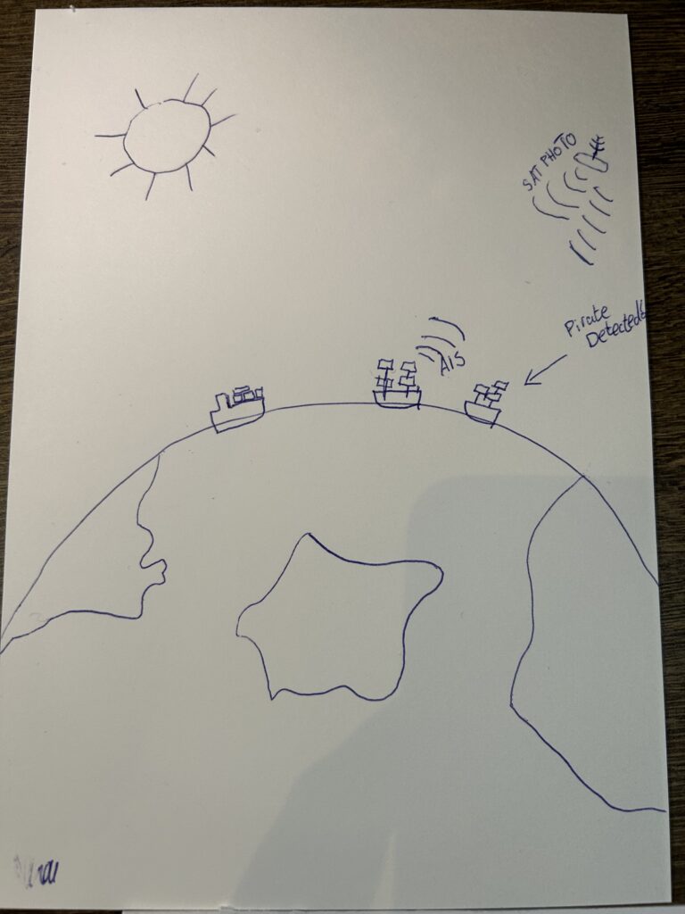
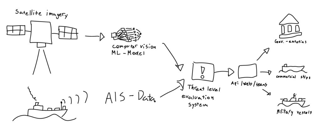
Piracy is a major threat to global trade, and it is crucial to have effective measures in place to detect pirate ships. Satellite images can play a decisive role in this context. With the ability to cover large areas and provide real-time updates, satellite images can provide authorities with the information they need to identify and track pirate ships, even in remote areas. By combining satellite images with other technologies, such as AIS data, a comprehensive system can be established to monitor the world’s oceans and keep them safe from pirate ships.
By using existing data sets, we can train models to recognize ships from satellite images [1]. By comparing the number of ships found on AIS data to the number discovered on satellite images, we can find out how many non-commercial ships are in an area. We then make the assumption that if non-commercial ships are close to commercial ships in an area where the threat is high, potentially dangerous situations may arise.
AIS stands for Automatic Identification System. It’s a technology used on ships and boats to broadcast their location, course, and speed to other ships and shore-side authorities. It helps prevent collisions and makes it easier for ships to navigate in busy shipping lanes.
This model must then be linked to a portal where authorities can receive early warning that they should be paying extra close attention in a certain area.
The distance to the nearest coast guard or military vessel from AIS data can also influence the level of threat.
By combining our custom ML solution with open AI data, we can predict where pirates are located. This allows us to warn shipping companies so they can prepare their ships by taking a different route or fighting against the pirates.
If we have time, we will expand the functionality of the solution by offering alternative pirate-free routes for an additional fee