
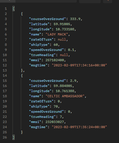
To find out if there are pirates in the waters where commercial ships operate, we will compare data from AIS (Automatic Identification System) with satellite images from the same area.
If there are more ships in the satellite images than the AIS data shows, we will trigger an alarm. This alarm alerts via flashing lights (Zigbee), Teams and an app we build ourselves.
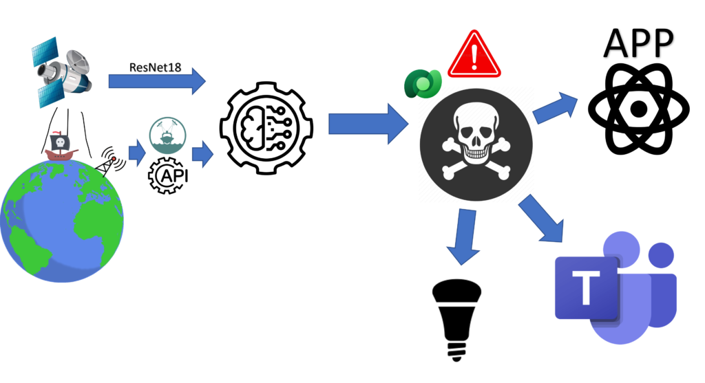
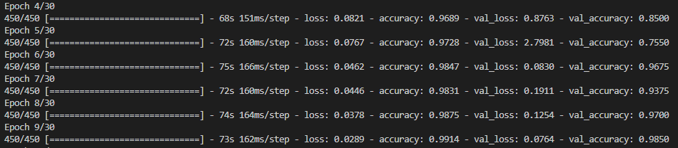
The image analysis itself is carried out using the ResNet architecture, which Herman has written himself with Python. We get the satellite images from open APIs, the same with AIS data.
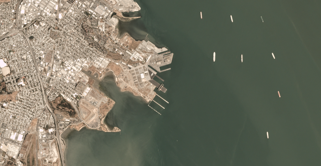
The comparison takes place by counting the number of ships on the satellite image within given coordinates, then we compare that number with the total number of ships we find through AIS. If the number is unequal, we assume that there are pirates in the area.
This finding is posted in a table in Dataverse, where we have a Power Automate flow that picks up new rows and sends them to our Teams app in addition to triggering a red warning light in Philips Hue.
We also have a React web app that presents data to the emergency response team that keeps track and notifies the right authorities and ships.